
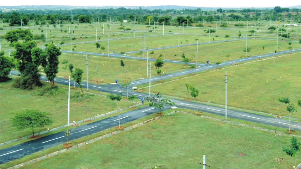
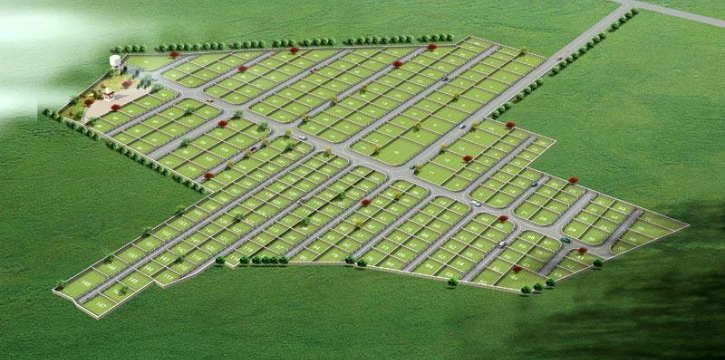
Cadastral error in the location of the boundaries of the land - this is the process of discrepancy of information that is indicated in official documents. The error is usually detected in the data that is necessary when entering into the inventory. Sometimes it can be made by specialists of the cadastral authority.
The reasons
The flaw, which is present in the cadastral plan, may be made by engineers. As they study the documents for the registration of the land. Or government agencies that incorrectly indicated the scheme or category of land. Such errors are associated, as a rule, with incorrect measurement, calculation of the area, determination of coordinates.
Varieties
According to the main classification, cadastral defects can be divided into two types:
- technical;
- registry.
Technical errors
Such an error is understood as the difference in the information entered into the electronic system. As well as data that are in the cadastral documentation. It turns out that this is the result of inattention and lack of specialists of the cadastral service. These include:
- typo;
- incorrectly written numbers or computational errors in the calculations;
- not fully entered information;
- Incorrect site address
- inaccurate information entered in the database, with documentary errors in previous documents.
The process of correcting errors in the location of the boundaries of the land is usually not a problem. You can fix it very simply. And even if necessary in a short time. What can not be said about registry errors.
Registry errors
Here, the error is hiding specifically in printed documents.
Cadastral engineers, specialists from municipal authorities and land surveyors meet such oversights. They appear in the following:
- Incorrect plot boundaries
- allotment area is inaccurate;
- inaccurate land surveying;
- irrelevant information in the boundary plan.
This type of cadastral errors is considered very serious in comparison with the technical ones. And changing the registry error is more difficult.

Troubleshooting
Cadastral error in the location of the boundaries of the land can be corrected in pre-trial order. But it depends on the date the incorrect information was entered into the registry. If the error was indicated in the register before the spring of 2008, then the engineer who came to the site will specify in the cadastral plan its coordinates. And indicates where exactly the border between other sections. If the plot is superimposed on neighboring ones, then they are pushed back. The owners of such lands are notified of this in a specific order.
If a data error was made after 2008, then unilaterally resolving the situation is impossible. In such situations, it becomes necessary to file an application for correction of the error. Together with the application of the documentation both for a specific plot and for land in the neighborhood. It is also necessary to obtain a special act from the state body on land resources for coordinating the boundaries of a land plot and contact an engineer to draw up a land plan for a specific plot. Within one month, the cadastral service issues a decision: to correct inaccuracies in the location of borders or to refuse to change them for specific reasons.
Court order
When resolving the issue in this order, a specialist is invited to the area to clarify the boundaries of the land, to draw up a boundary plan. A special plan is shown to neighbors who agree in writing to define other boundaries. After they receive a notice on the approval of the location of the border of the land, you must provide the specified data to the municipality. Such a process is applicable if it is not possible to voluntarily resolve the situation in a peaceful way, or rather, in a pretrial order. The prerequisite for the start of the trial is the submission of a statement of claim to a special body in order to correct the cadastral error.
Practice
In the usual case, the hearing to correct the error is as follows. For example, in a decision of 2015, the Oktyabrsky District Court established the presence of a cadastral error and decided to fix it. In the framework of this trial, a special authority established that there is a common land plot, but its coordinates do not coincide with the existing description of the location of the boundaries of the land plot. In this regard, this common area is imposed on adjacent lands. Their owners were applicants on a controversial issue. Subject to certain circumstances, the court seized the legislative opportunity and attracted land surveying specialists to participate in the process. After that, he issued a decree that it was necessary to amend the data on adjacent sites.
Thus, the court corrected cadastral information about the location of the boundaries of the land. But we must admit that the practice of considering this category of cases is not considered uniform. Sometimes in such situations, the court makes other decisions. Often the indicated evidence becomes insufficient to draw a definite conclusion. In this case, the court, at the request of the plaintiff, conducts an examination. In many ways, the outcome of the case depends on the results of the cadastral check. And also from the opinion of a third party. The presence of cadastral errors in the location of the boundaries of the land is recorded in a document that defines the category of land.

Application
The lawsuit must be filed with the court at the location of the land. The plaintiff in the case is a person whose interests are violated by the presence of a cadastral error. The defendant in the case is the owner of the site, which is located next to the controversial. Without fail, a specialist in cadastral registration takes part in the process of eliminating defects. He must be present to speak out about objections to the location of the boundaries of the land. Basically, issues related to the correction of cadastral inaccuracies are considered in accordance with the fundamental rules of civil proceedings.
The presence of a cadastral error may entail certain violations in transactions. But this situation is not final, because the law provides for a special procedure for protecting the rights of land owners. It is possible in practice to execute such an order, as well as achieve a positive result in the form of correcting inaccuracies. The main thing is to understand that you need to achieve a result that will suit everyone. Persons participating in the proceedings must accept conditions that do not change the boundaries of their land. Otherwise, they can, on such grounds, apply again, and the whole procedure will have to be completed anew.
Effects
It is incorrect to say that a cadastral error in the location of the boundaries of a land plot can do tremendous harm to the owners of certain objects, because there are also positive signs. In accordance with them, land owners in some situations only win.For example, if the data on the specific use of the site are incorrectly calculated, then citizens can receive the lowest rate as a percentage of the property charge.

But whatever the outcome of the lawsuit, the legislation contains information about the responsibility for making errors. More precisely, a fine will be applied. In the event that the authorized body does not correct erroneous information in the allotted time.
For example, if the engineer of the cadastral service once made a mistake in calculating the boundaries of the site, then for such actions a small monetary penalty is provided. If an error is made several times, the size of the fine increases. It may vary from the consequences due to the introduction of inaccurate data. And the court can be considered as a deliberate act.
Changes
Since January of this year, Federal Law No. 218 appeared. It regulates relations that affect the registration of property rights to property, as well as its registration. Article 61 of Law No. 218 lists the causes of possible inaccuracies and options for eliminating errors that were entered into the Rosreestr database.
It is interesting that after this law became legal, a legal definition of a cadastral error appeared.

Entering Information
In accordance with article 28 of the Federal Law on changes in the cadastral error, such situations can be resolved in several ways:
- providing information about the error to a special department of Rosreestr (i.e., you need to submit the entire list of securities specified in article 22 of this federal law);
- appeal to the court;
- appeal to the cadastral registration authority if any error is found in the information that deals with the issue of its correction.
Administrative order
In practice, situations related to the introduction of incorrect data in the documentation are resolved peacefully. For this, authorized bodies are not involved in the process. In case of contentious issues, it is better to take the following actions:
- The most basic thing is to file a complaint with the cadastral engineer. In order to eliminate the resulting inaccuracies.
- In this case, if land surveying has not been carried out, a certain proposal shall be submitted by the owners of neighboring lands.
- You can submit a special application on the site. It will confirm the existence of the grounds and subsequently lead to the correction of the data.
- The last step is to submit a document to be certified. He goes to the department of Rosreestr to find out if changes are made to the information.
Features
The main thing you need to pay special attention to is information errors, as they mean that the boundaries of the site will be changed. This will entail certain consequences for the owner. Then it will be necessary to reissue all the documents, indicating the correct data. But for such actions it is necessary to obtain an act of coordination of the boundaries of the land. Disagreements may arise with neighbors on this issue, which will need to be resolved. For the owner, an error can mean an increased payment of taxes, because when the land on the documents is larger than actually, the price changes.
Therefore, in order to quickly resolve this issue, it is necessary to carry out repeated work on cadastral registration. It is advisable not to wait for a long time, because the situation must be resolved promptly before the consequences. Contact the engineer and the real estate accounting authority and repeat the procedure.
In such situations, it is important that much depends on the calculation of the engineer, because it is he who conducts the survey of the site. In other words, to correctly indicate the data of his prerogative.
It will be difficult for the owner of the land plot to find an error in establishing the location of the boundaries of the land plot, because for this it is necessary to have special knowledge.In order to independently determine the boundaries of the site, you also need experience that will allow you to make calculations without errors. And also need geodetic instruments. That is why different types of cadastral errors occur very often. And the settlement of disputes on such issues in court is allowed in the presence of circumstances when it is difficult to solve the situation in another way.
Many citizens resolve disputes with neighbors in the plots by negotiation without service interference. After all, with the help of special organs it is possible to solve the problem, but it will only take more time. Therefore, it will be more fruitful to get together with people who have claims and think about how to resolve inconsistencies in the location of the boundaries of land in order to get out of the situation without causing damage. It is important that the solution to the problem is aimed at satisfying the interests of all persons, because inattention to the opinion of one of them may serve as a reason for this citizen to go to court. And you will have to calculate the boundaries of the site again. Therefore, it is very important to comply with the deadlines, and most importantly, not to miss them, and to draw up all the necessary documents in time.