The concept of a multi-contour land plot has recently been introduced by legislation. Previously, the term “single land use” was used in relation to such objects. As part of the article, cadastral registration of a multi-contiguous allotment of land is considered. This is a very important element in the implementation of land relations. This system guarantees owners the exercise of their rights regarding real estate, especially land plots. If this object does not have certain boundaries, then it is impossible to exercise its rights as the owner of the allotment of land.
In many countries, the cadastral registration system is undergoing reform. Russia was no exception to this rule. The demand for information from the State Real Estate Cadastre is growing annually. This information is gaining new application in practice and can be used for various purposes. In our country, cadastral registration ensures the rational use of land and control that this use is carried out for its intended purpose. This principle is embodied in the main legislative acts that govern the relevant legal relations.
The concept
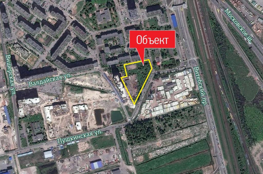
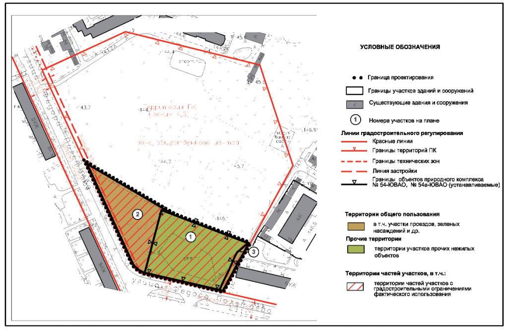
A multi-contour land plot is real estate with borders, which together comprise several closed-loop contours. Moreover, each of them does not constitute a separate land plot. The boundary of a separate contour may be the same as that of a part of a multi-contour plot of land in the case when in the framework of this contour property rights to a multi-contour allotment of land are limited.
Each of the contours of the corresponding border of the land is divided with other contours of the border of other plots. As a result, a multi-contiguous allotment of land has no common borders. Chapter 1 of the RF Labor Code provides for the features of how a multi-contour land plot is created.
These are, in particular, the following methods for creating multi-contour plots, carried out in relation to:
- Plots owned by municipal or state ownership.
- From divided, allocated or redistributed allotments.
Education
The formation of a multi-contour land can be carried out from a combination of standard plots. According to Art. 11.6 of the LC RF, the association is used only in relation to adjacent sections, that is, having common borders. That is why the formation of multi-contour plots of land from allotments that do not have common borders is impossible.
At the same time, if a multi-contour allotment of land is put on the cadastral register or common land use is taken into account in an earlier period, then the creation of new plots becomes possible. At the same time, a single land use, which was taken into account earlier, or a multi-contour allotment of land can be combined with another plot, if its borders along at least one contour are adjacent.
Union
After the combination of land, a new multi-circuit or ordinary allotment is created. At the same time, the original land ceases to exist from the moment of state registration for new allotments of land. This is stated in Article 11.6 of the Code.
Redistribution
Several adjacent multi-contiguous plots of land, as well as their combination with ordinary plots, can be redistributed.After this, other lands are created, and the original ones are terminated from the moment of state registration. This is stated in Art. 11.7 of the Code. At the same time, as in the previous case, the redistribution of a multi-contour land plot implies the presence of adjacent borders at the initial allotments.
Highlighted
One or more land may be created as a result of the allotment procedure. The multi-contiguous allotment of land from which the allotment was made remains. This is stated in Article 11.5 of the Code. But it has new boundaries.
Article 11.9 of the LC RF
The provisions of the RF Labor Code, which state that during the division the initial allotment remains within the changed boundaries, also apply to multi-contour land.
This is important to note. Created land must meet all the requirements of the law that is valid at the moment. The relevant information is specified in Article 11.9 of the Code. It is as follows:
- The maximum minimum and maximum sizes of land plots in relation to which urban development regulations are established are determined by them.
- When creating allotments, there can be no effect of wedging, broken borders, the impossibility of erecting structures, streamers and other shortcomings. This prevents the rational use of land, and at the same time is a violation of the requirements of current legislation.
- The limits of allotments for which these regulations do not apply or are not established are determined by the RF RF and other laws.
- Both the unification of land plots, and their division, redistribution or allocation is impossible if the restrictions on them prevent their use, in accordance with the law.
- Borders of allotments cannot cross settlements or municipal formations.
- Land plots for individual housing construction cannot be created if as a result it will be impossible to use the real estate objects that are located on them.
Border crossing
This concept refers to the practical intersection by any contour of the boundary of a multi-contiguous allotment of land. The location of any of them outside the municipal type or settlement supplements this definition.
All contours of the border of the respective allotment of land may be in different quarters of the cadastre. However, they are located on the territory of some entity or settlement (one). So, the location of the land can be characterized by the boundaries of several contours. An example of this is agricultural land used for the pipeline, power transmission lines and communication lines of other objects.
Part of a multi-circuit allotment
This object may consist of:
- One contour border. Then the part completely coincides with it or is created from its component.
- A certain number of border contours. In this case, the part coincides completely with a certain number of circuits or is created from their components.
In the latter case, a part of the corresponding land is created with a boundary of several contours. As in the case of a multi-contour allotment, the same land surveying is applied to this part.
For free, the new law allows this procedure to be carried out under the federal program until 2020. This is possible when buying out or concluding a lease agreement for a municipal allotment, as well as when performing complex cadastral works in large areas.
GKN
The main provisions relating to the issue under consideration are presented in the Law "On the State Real Estate Cadastre" No. 221-FZ. According to him, the State Property Committee is a systematic set of data on property of an immovable nature, which is recorded. This also includes data on the border crossing of Russia, on the borders between regions, municipalities, settlements, territories with a special condition for use, and other information.GKN is a state resource of federal significance that accumulates relevant information, including the right to use a land plot in some cases.
Cadastral registration refers to the relevant actions of the authorized body to enter data on real estate in the State Property Committee. By means of them, the presence of a property having certain characteristics is confirmed, and thanks to which it can be defined as an individual thing. Appropriate actions may confirm the refinement of a multi-contour land plot, the cessation of ownership of the property, its existence, as well as other information.
Information on how GKN is maintained is contained in Order of the Ministry of Economic Development of the Russian Federation No. 42 of 4/10/2010. g.

Real Estate Cadastre Sections
The above law on the State Property Committee contains information on which sections are available in the real estate cadastre. In particular, these are:
- Property Register. It includes records of real estate by describing data on the relevant objects in the State Property Committee. This information is in the Unified State Register of Rights, where you can find out about existing and ceased to exist real estate rights, information about this real estate and their owners.
- Cadastral affairs. In this case, we are talking about a set of systematized documentation, on the basis of which the relevant data are entered into the SCN.
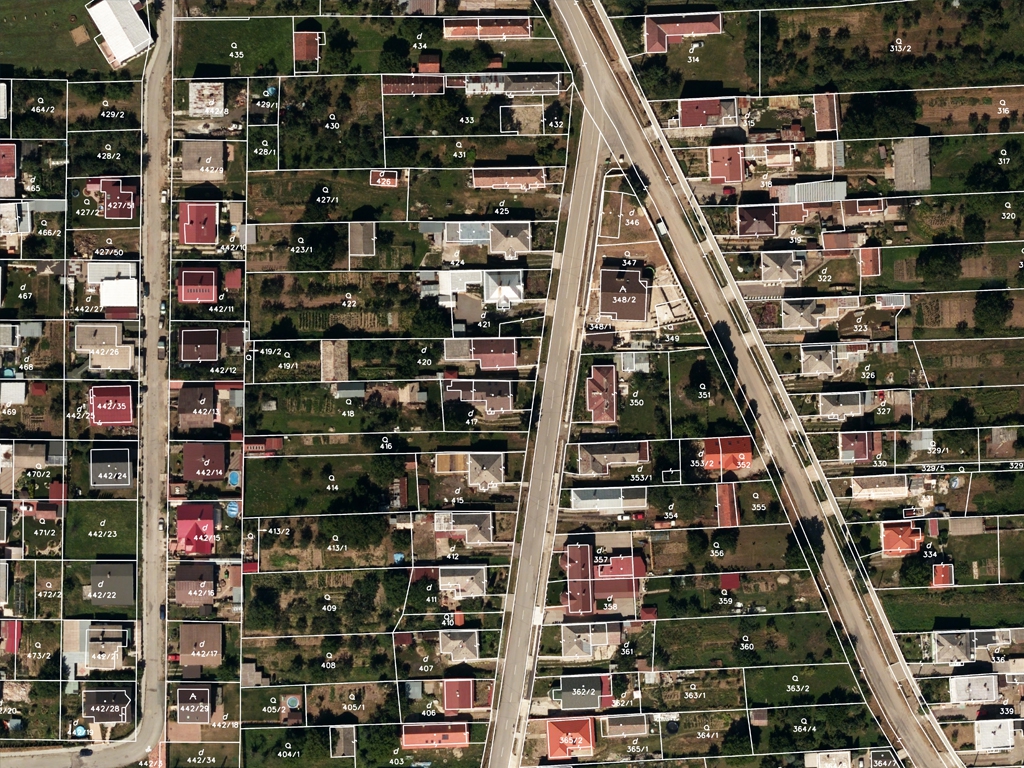
- Cadastral maps. These are thematic maps, which are compiled on the same cartographic base. They reproduce information on allotments of land, prefabricated buildings and at the stage of construction in progress, borders (state, between regions, municipalities, settlements, territories with special conditions of use, cadastral division). These cards are authorized to conduct the cadastral registration authority. Information is provided to applicants without restrictions.
Record keeping
When it is necessary to enter cadastral data into the register (for example, on the right of ownership or the right to use the land plot), specialists of the cadastral registration body carry out the following actions:
- Enter data on objects that were previously considered.
- They register the property in the State Property Committee.
- Keep track of changes to this object.
- Removed from the cadastral register.
- Indicate the data according to the documents received by the cadastral registration authority from state bodies or local authorities through the established communication of information interaction.
- Correct errors of a technical and cadastral nature.
Information Status
This property information may be displayed in the Register as follows:
- Previously recorded.
- Contributed.
- Temporary.
- Accounted for.
- Archival.
- Canceled.
These statuses change as a result of the adoption of an appropriate decision by the cadastral registration authority. For example, objects that have a “temporary” status set, change it to “recorded” if a land plot has been registered. In this case, the relevant information should come from the registering authority in the order of interaction.
The “temporary” status may be changed to “canceled” if:
- The first one expired, but the SCN did not receive information about the registered rights to the land allotment.
- The cadastral registration authority received data on the removal of the site from the corresponding registration of real estate objects, in relation to which a “temporary” status was previously established.
- The owner or the person, in respect of which the restriction is established, submitted to the authorized body an application for deregistration of a part of the land allotment that has a “temporary” status.
These changes are dated in the afternoon when the employee of the authorized body made the corresponding decision or when the period of “temporary” status has expired. In this case, the validity period is indicated.At the same time, this status is not assigned in relation to structures under construction in progress. Information that the land plot has been created, as well as the establishment of encumbrance, is included in the Register with a "temporary" status.

Features of the presentation of GKN data on multi-contiguous plots of land
The information contained in the SCN may be provided to any persons upon request. They can be prepared in one of the following types:
- Copies of the official document, on the basis of which the data are entered in the State Committee for Civil Protection.
- Cadastral extract. It contains real estate data. If the object about which information is requested no longer exists, then this document should contain information about the termination of existence.
- Cadastral passport. This is an extract from the State Property Committee, which contains the data required for the state registration of a land plot for a particular person, or a transaction with this allotment.
- Cadastral plan. This is a thematic plan of the corresponding quarter or other territory indicated in the request, but within the quarter drawn up on a cartographic base, and in which the necessary information is reproduced.
- Cadastral certificate. This is a set of relevant data on real estate located in the territory indicated in the request.
The data specified in the State Property Committee is mainly provided within ten days from the receipt of the request. However, to provide cadastral plans or certificates, specialists are given a maximum period of preparation, which is fifteen days or thirty days from the date of receipt of the request.
If the requested data cannot be provided by law or is absent, an informed decision will be sent to the applicant within five working days.
If a cadastral passport or statement is drawn up for a multi-contour land plot, it is necessary to indicate the number of border contours of the respective allotment, as well as a list of accounting numbers and the area of each of them. If additional information is required, which is contained in the State Real Estate Cadastre, then it can be provided.
There are times when the list of account numbers does not fit in the appropriate section. Then you can arrange it on another sheet, where the list is executed in the form of a table indicating the area of the land allotment and possible notes. This sheet must be signed by an authorized person and have the seal of the issuing authority.
When a cadastral passport or the corresponding extract of a multi-contour allotment of land is drawn up, a plan of this allotment is displayed on such a scale that the readability of the inscriptions on the image is ensured. If it was not possible to place the whole plot on one sheet, then this is done on several sheets, including using sidebars.
The amount of necessary data provided by the SCN may be indicated by the applicant in the relevant request. If the data is necessary in relation to the recorded land use, then in the provided document the site is called “single land use”.
Allotments for which cadastral registration was completed prior to the entry into force of the Law on State Property Committee (for example, land plots for individual housing construction) are called “previously recorded”. Data about them should contain information that is available in documents issued by the State Real Estate Cadastre. But regardless of whether data on multi-contour allotment of land or previously considered plots are required, information is provided in the form of a cadastral passport or statement regarding real estate, the right to which arises after the state registration. However, the same information regarding the plot, which is part of the unified land use, is not provided.
Conclusion
From the article we found out that a multi-contour land plot is a real estate object with borders, which together comprise several closed-loop circuits.
Some areas of cadastral legal relations are currently undergoing changes, while others remain unchanged. For example, despite the fact that according to the law "On State Cadastral Assessment" No. 237-FZ, land surveying is possible for free, the new law does not give ordinary citizens the right to undergo a procedure without money. Therefore, for registration and clarification of the boundaries of the site, you will have to, as before, pay.