In questions concerning land plots or land surveying, disputes arise very often: "Who owns this land?" How to solve the question when it comes to public facilities? Let's try to figure it out, the common area is what, what lands belong to it?
Firstly, these are those that can be used by an unlimited number of persons. These areas are not subject to restrictions. In accordance with Art. 85 of the Land Code of the Russian Federation, general purpose lands cannot be transferred to private ownership, although there are exceptions. Some objects in rare cases can be rented.
Secondly, these are lands that are in municipal or state ownership, but citizens have free access to them, they can use them to the extent permitted by legal norms.
What applies to public lands?
Common areas are, first of all:
- boulevards and embankments;
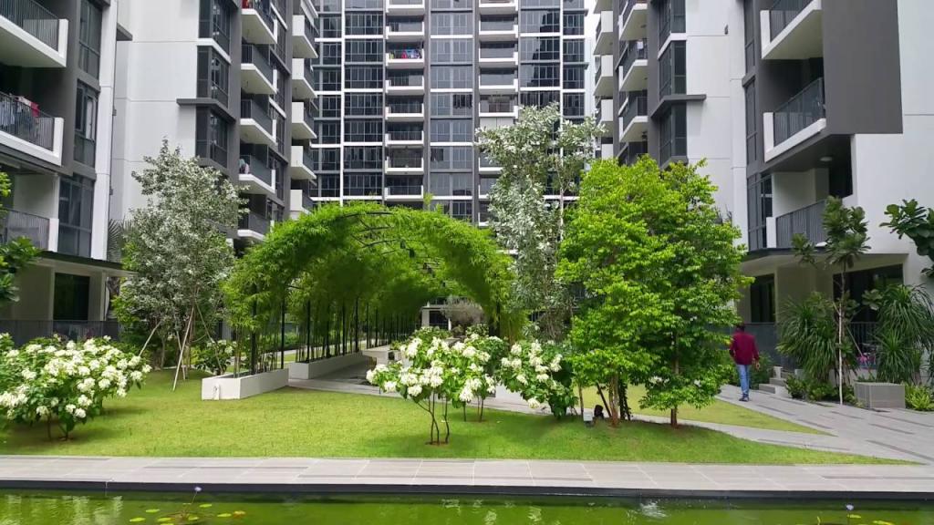
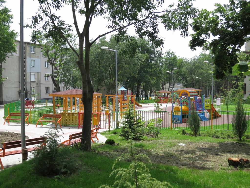
- city gardens, parks;
- streets, squares and driveways;
- roads;
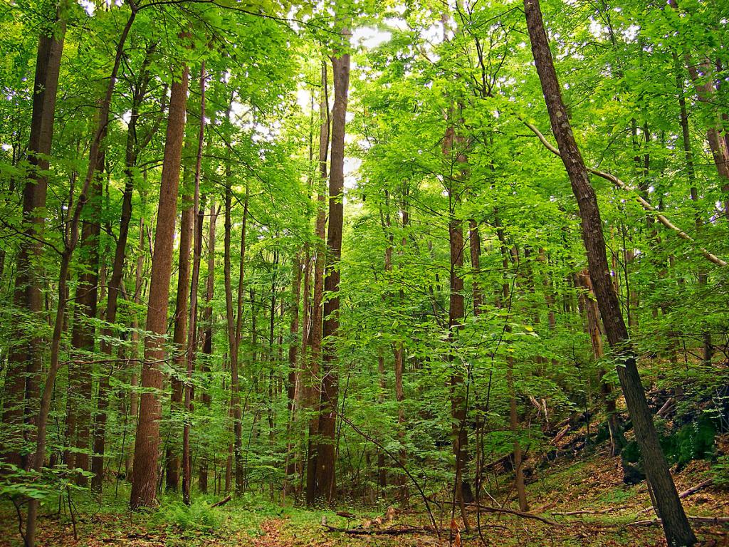
- forest parks and urban forests;
- beaches and water features.
Each of the categories of common areas has its own characteristics of use by citizens.

How can public land be used?
There are several options for using common areas - these are:
- Use of the territory free of charge. Most of the land available within villages and cities cannot become the property of an individual. But anyone can dispose of common land in unlimited quantities and at any time (for example, walk in parks and squares).
- Lease of land for general purposes. They rent a territory when they want to erect a building on it. This transaction is made between the state and the legal entity. An important nuance of the contract is that this territory cannot be redeemed.

Land Use Tax
Citizens using general-purpose land must pay tax. This question has features:
- If the territory is used as a transport highway, then this tax is considered a transport tax, and is divided by the number of users.
- Citizens who rent a land plot pay a tax if they have any real estate on the territory. If there are no documented buildings, then the person is obliged to pay the rent.
- If public land is in the use of partnerships, then the tax is divided in equal shares between all participants.
Use of public areas is taxed depending on the development methods.
Illegal use of land
Illegal use of common areas is a serious violation that threatens punishment. If, for example, a citizen does not have documents proving the right to own land and lease a given land plot, the punishment may be as follows:
- Penalty and demolition of all illegally erected buildings. In this case, the citizen must pay a fine, demolish all the buildings at his own expense and return the site to its original form.
- Fine. The amount of payment is calculated depending on the location and size of the land.
The amount of fines:
- 500 - 1000 rubles (to individuals);
- 1000 - 2000 rubles (to officials);
- 2000 - 20 000 rubles (to legal entities).
To report illegal use of the territory, it is necessary to apply to the local administration.

Land issues between neighbors
The land theme is very relevant for land owners. Disputes between neighbors on this issue are not uncommon, for example, if they have a different idea of using a common road or access to the site. In some cases, the court allows one of the citizens to exercise control over the highway, which is used by the owners of neighboring sections. At the same time, this citizen should not impede traffic.
If one of the neighbors tries to seize and illegally move the borders of its own site, then in this case the dispute is resolved by surveying the territory of general purpose.
General Purpose Territories in SNT
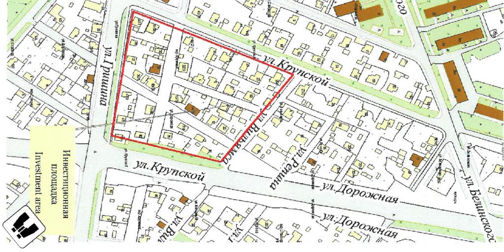
Garden Nonprofit Partnership (SNT) may allocate a land plot on the territory of common use for economic activities and the garden. A cadastral passport is drawn up for the allotted land, according to which the boundaries of the plot are established and a scheme of the existing buildings is attached. With the help of land surveying, the boundaries of neighboring sites are determined.
In order to register general purpose territory in SNT, it is necessary to present the following:
- documents for land and the right to use;
- allotment plan (according to land surveying);
- list of land owners;
- constituent documents of SNT.
This package must be provided to local authorities. Based on the data of land surveying and additional documentation, a territorial plan is drawn up, which indicates private land and common land.
Green area
The presence of citizens in a forest area may be restricted or prohibited in accordance with federal law. This happens when specially protected areas, security and defense lands and others are located in the forest. The presence of residents in the green zone is limited when it is necessary to ensure:
- safety of people during any work;
- sanitary and fire safety in the forest.
In other cases, every citizen can freely be in such a zone, and there is nothing to pay for it. Also in this territory it is possible to collect various natural resources for use in food: berries, mushrooms, wild fruits, nuts, etc. The forest territory, provided for general use to residents and legal entities, can be fenced (in accordance with the Forest Code).
Town-planning activity in the territory of general purpose
According to the Urban Planning Code of the Russian Federation (GRK RF), using the red lines on the cadastral map, the existing or planned boundaries of common land are indicated. The boundaries of the land plots on which the linear objects are located or in the future will be placed are also indicated.
The presence of red lines should be considered in the following cases:
- land surveying;
- drawing up urban plans;
- reconstruction or development of land;
- layout of municipal common areas;
- paperwork for the right to own, use and dispose of the territory.
Existing red lines separate common land from those of private use. If the municipality in the future decides to expand public territory or roads to the red line, which runs through private land ownership, then the necessary distance will be redeemed from the owner of the site on the basis of an agreement.