The welfare of society at all stages of development depends on the ability of people to manage the indispensable natural resource - land. Unlike other production factors, it is non-moving and spatially limited. Earth acts as the basis of material wealth, the most important element of the natural environment. It is characterized by quantitative, qualitative and territorial heterogeneity, variability of characteristics. 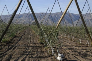
Resource value
The social role of land is most fully revealed in the agricultural sphere. Here, the production process has a direct relationship with the properties of this resource. Land acts as agricultural land, characterized by different fertility: effective (economic) and natural. As a means of labor, the resource is characterized by plant productivity and soil quality. Acting as a subject of activity, it differs in spatial and technical and technological properties. The effective functioning of all national economic sectors, as well as the welfare of society, depend on the competent and rational use of soil.
Resource Issues
Currently, there is a constant increase in the need for land for the implementation of non-agricultural tasks. The best territories are almost completely developed or distributed between settlements, industrial enterprises, roads, pipelines, airfields, communication lines. Land is also used for the disposal of household, industrial and agricultural waste.
Effective solution
In connection with the foregoing, the state faces the most important task. The control unit must protect the environment. This, among other things, includes generally rational use of natural resources and the use of land in particular. For this, an integrated system of monitoring the state of resources, assessing and forecasting likely changes under the influence of anthropogenic factors has been formed. The tasks of state land monitoring are to regulate the quality of the environment, ensure the productivity of resources, and prevent pollution. 
System essence
State monitoring of land and land management suggest the use of special measures to increase soil fertility, intensify use, and reduce anthropogenic impact on the resource. Observations make it possible to timely detect changes, predict and develop recommendations for eliminating and preventing the negative consequences of influence, and ensure cadastral activities.
Goals
State land monitoring It is a system that performs the functions of information support of environmental sustainability. Before deciding on actions related to a resource, it is necessary to analyze a large number of reliable and periodically updated information about its status. State monitoring of agricultural land is carried out to obtain the necessary information, eliminate any uncertainties, identify data gaps. In this regard, the following areas of programs are distinguished:
- Getting information that is associated with a specific problem.
- Providing information to different types of audiences (members of the public, government, enterprise administration, etc.), as well as its dissemination.
- The adoption of the necessary measures aimed directly at improving the situation or pursuing the goal of achieving the adoption of facilitating decisions.
Key points
State monitoring of agricultural land includes:
- Organization and conduct of observations of qualitative and quantitative indicators (their complex), which characterize the state of the resource, as well as the sources of pollution and their impact on the environment.
- Assessment of the ecological (actual) state of soils.
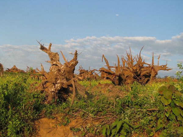
- Quality control of resources, water, soil during adverse agricultural activities, which provoked a deterioration in the properties of resources, erosion, a rapid decrease in fertility over large areas, as well as a forecast of the future situation.
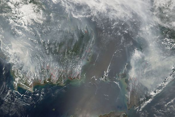
- Identification of new sources of pollution, determination of the dynamics of their influence, analysis of the likely development of processes that negatively affect the environment.
- Verification of compliance with the rules and norms established by the quality standards of resources when using them.
- Development of recommendations and planning of measures for rational land use, reduction of pollution.
- Prediction of measures to prevent damage, assessment of the alleged condition.
- Timely provision of information to state authorities, local governments, individuals, legal entities.
- Supervision of the implementation of activities.
Under the implementation of tasks should be understood as the implementation of certain actions on the way to achieving the goals. A well-designed program involves only those solutions that do not go beyond issues. State land monitoring should be properly organized. Only in this case, it is possible to achieve effectiveness from the events. In practice, it is possible for many years to conduct state monitoring of lands in a particular region, but not obtain the desired results. At the same time, a preliminary study of the situation, an assessment of the likely consequences, taking several measurements can contribute to the rapid identification of the problem.
Main procedures
State monitoring of land is a systematic comprehensive monitoring of the state of the environment, soil in particular. Previously, numerous studies and surveys, which were carried out by departments and ministries to analyze the fund, were carried out separately. The basis was the regulatory and technical documents. However, the main source of obtaining information during the assessment is considered to be the data that specialists receive during direct observation of the environment. The need for additional, new or more specific information appears at all stages of the analysis of the natural state. In connection with such an exceptional role of observations, in some cases this process itself is called monitoring.
Program status
State monitoring of lands performs a connecting and basic role among other similar programs, which determines its status. This approach allows you to provide comprehensive information about the status of resources and significantly reduce the cost of eliminating likely negative processes. The objects of state monitoring of land are all territories of the country, regardless of the form of ownership in the plots. The implementation of the program is mandatory in accordance with the level of administrative-territorial division. State monitoring of land is carried out for all categories of plots, regardless of the nature and mode of use.It acts as an integral part of the country's unified information system, containing data on the state of natural resources and the environment.
Classification
There are certain types of state land monitoring. One of the main ones, as was said above, is observation. Among others, it is worth noting various kinds of laboratory analyzes of the chemical composition of soils, comparing data and plotting the dynamics of changes, surveying, surveys, surveys, etc. 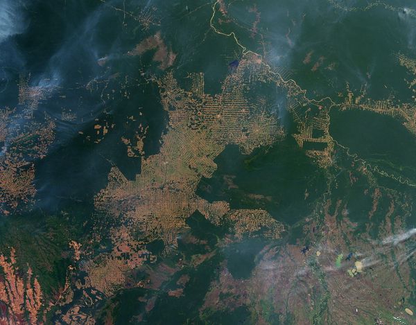
Program content
All activities that are carried out as part of monitoring are characterized by the following changes:
1. Squares and borders; plots, fields, land; administrative-territorial formations and other.
2. Soil conditions. This category includes:
- development of wind and water erosion;
- soil degradation in pastures;
- desertification;
- waterlogging, waterlogging;
- killing, overgrowing arable land;
- salinization
- destruction of soil aggregates;
- the formation of a dusty structureless deflationary dangerous surface;
- pollution by pesticides, chemical dispersed elements, heavy metals;
- change in humus supply and others.
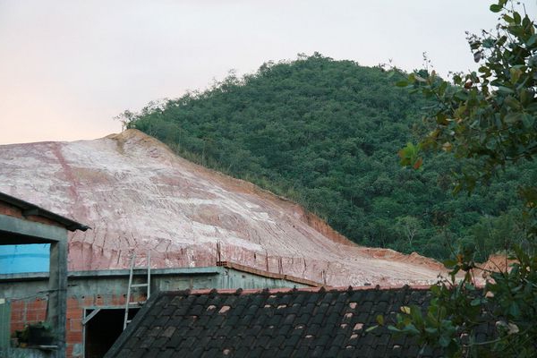
3. The state of the relief, geological environment, hydrographic network, water balance, hydrobiological and chemical compositions, coastal sea, lake lines. This also includes changes provoked by:
- moving sands;
- channel processes;
- earthquakes;
- mudflows;
- proven and existing quarries;
- heaps;
- surface subsidence;
- violation of the earth;
- developed peatlands, etc.
4. State of vegetation (perennial plantations, forests, pastures, crops, etc.) according to phenological characteristics (stages of development, phases, timing of occurrence), biomass, phytopathological foci, areas covered and not included in the Goslesfond, covered (felling, burning) and not covered by forest (land reserves).
5. Land conditions that are subject to the negative impact of industrial facilities. These include:
- settlements;
- treatment facilities and agricultural enterprises;
- reclamation systems;
- transport;
- sites for composting fertilizers, manure storages, TSM warehouses, bulk fertilizers, landfills, cattle burial grounds, places for the disposal of physiological and radioactive waste, parking lots.
These changes can be expressed in relative or absolute integral indicators for a specific period. For example, this may be the loss of humus per hectare, percentage, intensity and degree of degradation of the soil cover and other parameters. 
Access to resources
It is regulated by Art. 12 Federal Law No. 24 (dated February 20, 1995). According to the regulations, all citizens, bodies of state and territorial administration, public associations and organizations are given equal rights to access information resources. They are used in conducting the cadastre, registering property rights, performing land management, planning the efficient use of land, conducting land management, making decisions related to the organization of agricultural work, determining fines for violations of applicable laws, biological contamination and soil pollution, and more.