The time for paper atlases and maps has passed. It is difficult to use them while driving, because you have to constantly stop to check the map, get directions, find out your location.
If the journey passes through different cities and countries, then such atlases and maps will be needed a lot, but this is not too convenient. In addition, paper maps and atlases will not tell you about traffic jams on the road.
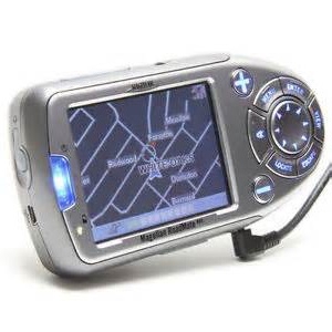
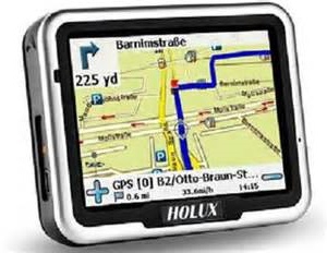
Motorists and travelers today trust electronic gadgets to drive their route. A modern navigator will help you find out the location of an object in any city, region, country. It will help you safely and quickly reach any point on the route, say that the path is chosen incorrectly, and the arrows show the correct option.
How to choose a navigator?
In the market of electronic products there are both car navigators of various brands with different functions, and pocket ones for fans of water, mountain and hiking. To answer the question of how to choose a navigator, you need to know how it works.
The principle of the navigator
How does the navigator work, what helps it to provide such accurate information about the route?
 The principles of operation of navigators are quite simple. The beginning of this system was laid by the US Department of Defense in the middle of the last century.
Today, around the world they know the GPS system (Clobal Positioning System). In orbit
There are thirty working satellites of the earth that rotate in six different planes and have their clear coordinates. They send signals to the Earth that are read by portable devices.
When you turn on the navigator, our position is fixed in relation to the three nearest satellites. Thanks to complex mathematical formulas that take into account the speed of light and the distance of the navigator to the nearest satellite, our exact location is determined. Our route is divided into segments that take into account both the distance and the presence of railway crossings, junctions, traffic lights, and permitted speed.
That is why many navigators offer not one option, but several: optimal, short and fast. Short and fast may not match. Geodetic parameters and arithmetic calculations are the basis of the work of navigators. What is the difference? How to choose a tourist navigator? What matters is the difference in the speed of information processing, the accuracy of the coordinates indicated to us, and the voice that issues commands. All this is provided by the navigator software.
What should be considered when choosing a navigator?
The first is software (software). It contains the most important components for the navigator, such as cartography and the navigation program. How to choose a navigator?
On the Russian market today there are several varieties of such a "filling" - iGO, "Progorod", "Autosputnik", "Navitel Navigator", Garmin. Which navigator to choose? Software should be selected based on the geography of travel. The main struggle unfolded between Garmin, "Autosputnik", "Navitel Navigator". They have detailed information about all regions of Russia, targeted plans, information about traffic jams. Numerous automotive forums are full of messages about the advantage of various systems. So where to stop? Navigator for cars - how to choose? Let us dwell on the positive and negative aspects of these three systems.
Navitel Navigator
Navitel Navigator is ready to provide maps of 60 countries, including current maps of Europe, Russia and Asia. Navitel.Traffic will provide the latest information on traffic congestion. This software has high-detail maps, a user-friendly interface, and good functionality. All this led to the popularity of Navitel among users. It is he who today occupies a leading position in sales in the Russian market.
Garmin
Garmin boasts an excellent interface, high detail and European quality workmanship. Moreover, all this applies not only to European cities, but also to Russian ones. The only mistake for developers is a rare map update. But the presence of an FM antenna that receives traffic information will allow the owner to save a lot of time and money. Other navigation systems use a GPRS connection for these purposes, and their owners have to shell out for Internet traffic in favor of mobile operators.
Software "Progorod", City Guide
Traveling only around Moscow and St. Petersburg, as well as their environs, the Progorod software or City Guide are perfect. Here, all emphasis is placed on the presence of traffic jams on the roads and possible options for their detour. And if most navigators use information from large specialized agencies (Yandex.Traffic), then City Guide itself recreates the picture of traffic jams. And "Progorod" will help the motorist deal with lanes at intersections and junctions on the roads.
It is worth saying that not only maps are part of the software of the car navigator. So how to choose a car navigator? The coordinates, estimated time of arrival and speed are also ready to give out this gadget, but how accurate they are will depend on the software. Navigators traditionally work with Android, Linux, Windows CE 5.0 and 6.0. Each of these systems has its own special characteristics that give navigators additional features. So which navigator is better to choose?
Android
Android is ready to offer the user a symbiosis from a tablet computer and a guide. In addition to its direct duties, the device can show a film or serve as a communicator. The presence of wireless Internet will make available most of the applications from the Android Market. The first of these devices is the Texet TN-550A. Wide functionality and affordable price made this model very popular among Russian users, which affected the growth of its sales.
Linux
Linux allows you to control your car navigator using voice commands. The driver only needs to give the exact address, and the device itself will find it on the map and make a route. It so happened that the Linux operating system is better protected from trojans and viruses compared to Windows. But this is not so true when working with a car navigator, since it only provides information about traffic jams, and does not open pages on the Internet and does not upload files.
Many manufacturers allow installing additional software on their navigators.
Resolution and Screen Size
An equally important characteristic of the navigator is the resolution and screen size. And how to choose a navigator, given these parameters? The best choice is a 4.3 ”screen. But if, in addition to the navigator, you also need a media player, then it is more logical to take a navigator with a large screen. Resolution and color - indicators useful, but not decisive. The schematic layout of streets and houses on the map is quite distinguishable by any navigators.
Control method
Another important parameter of the navigator is the control method. The motorist has to follow the route and set the following points on the go, and choosing a navigator for the car is not an easy task. Navigators with a touch screen and an interface adapted for the human finger have gained great popularity in the market today. This allows you to accurately and quickly set your waypoints.
So the navigator Lexand SL-5750 convenient location of the sensors allows you to access any of the functions in just one second. Garmin company has proposed its own solution - navigators controlled by voice commands (Garmin Nuvi 3790T). But the latest model received a lot of negative reviews from Russian users due to the slow laying of routes and fuzzy recognition of voice commands.
Chipset Type and CPU Power
Other parameters that affect the performance of the navigator are the type of chipset and processor power. How to choose a tourist navigator? Here, by analogy with a home computer, it should be understood that the higher the processor power, the faster the data will be read. 300 MHz is quite suitable for solving standard tasks, but if you watch video, then you need more power.
Chipset - this is the component that determines the speed of communication with the satellite, as well as the accuracy of points of construction of the route. Most manufacturers today use Atlas and SirfStar chips. How to choose a navigator? The main selection criterion in the case of the chipset is how many channels of received signals it can provide. The higher this number, the better the navigator model. So on the market there are models with the SiRF Atlas V chipset that can receive a signal on 64 channels.
Hot cold start
Hot and cold start - which navigator to choose? When choosing a navigator, surely many sellers pay the buyer’s attention to the models with the fastest hot and cold start. Is it important? The concept of “start” is the time that the device spends on establishing communication with the nearest satellite. If the sensor has not been used for a long time or the car has crossed the time zone, which means that the coordinates have changed, then the navigator has to establish communication with satellites from scratch. How quickly this happens determines the cold start time. A hot start indicates the time that the navigator will spend on the connection after a short shutdown (power change, reboot), that is, when a sudden sudden loss of signal occurs. This often happens when driving under a bridge or through a tunnel.
In large cities, the purchase of a navigator is dictated not so much by the need to lay a route from point A to point B, but by the ability to quickly reach a given route, possibly bypassing traffic jams. How to choose a car navigator for this purpose? In this case, he must fulfill one goal - to see possible difficulties along the route. The following information will help determine the choice of those users who have developed just such a situation. She will give them the answer to the question of how to choose a navigator.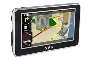
The most simple and budget option for the car owner - a device with a radio antenna. Navigators that have a GTM 21 or GTM 2 antenna are automatically connected to a single information server.
That is, the navigator works like a radio receiver, receiving traffic information, and displays it graphically on the screen. At the same time, there is no monthly fee.
Today, only one brand in Russia can offer a similar solution to the problem for motorists - this is Garmin (the minuses and advantages of this navigation system were discussed above). Garmin nuvi 3490Lt or Garmin nuvi 1410 are worthy representatives of this category.
Most of the navigators, in order to obtain relevant information, resort to the help of the Internet. And the way to connect to it divides the entire market of navigators into two parts - using Bluetooth or built-in GSM / GPRS. The first type of navigators use a mobile phone as a modem. The main advantage of this type of connection is the speed of information.
However, the intricacies of the system connecting the phone and the navigator, which requires a password, changing settings, is not very suitable for use every day.And, in addition, traffic in this case grows to sky-high peaks, which affects the bills for mobile communications. Globus GL-700 GPRS, Shturmann Link 500 FM, Lexand Si-515 pro HD are worthy representatives of this group.
Navigators of the second type have a SIM card slot for connecting to the Internet. How to choose a GPS navigator? All that is required is to purchase a SIM card that supports GPRS-internet from a mobile operator. A good GPS navigator will serve faithfully and require only one thing - the availability of funds in the account.
The automotive and travel equipment market is growing very fast. Technical thought has already allowed navigators and car recorders to appear on the market in one bottle, TV navigators and other similar devices. And there were also devices that combine the functions of a motorcycle, aviation, marine, bicycle and car registrar, which allows you to travel anytime, anywhere.
Conclusion
But the key to any successful purchase is a clear definition of your needs. It is necessary to determine the conditions and place of use of the navigator: city, motorways, forests, desert, off-road, mountains. It is worth considering additional options, whether they are needed. If the whole "journey" will fit within the same area, city, then you can choose a simpler model. The price range is wide today: from 1.8-2.3 - budget options, up to 5-6 thousand rubles - the average price category. Let's hope this article tells you how to choose the right navigator.