The type of permitted use of the land belongs to the list of its characteristics as a property. The legal sources of this concept are simultaneously land and urban planning legislation.
What land use is permitted
The concept of "permitted use of land" means that in the process of operation both the intended purpose of the land and additional requirements are taken into account, the sources of which can be legislative acts of federal authorities and constituent entities of the Russian Federation, as well as acts of local authorities.
Therefore, this legal concept includes both the power in the form of permission to use the land, and obligations, including the obligation to use the land for its intended purpose and in accordance with the restrictions established by the legal regime of the land.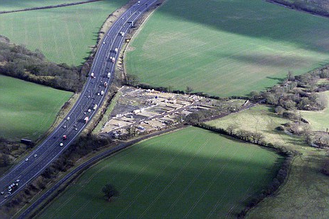
Legal sources of the concept of “type of permitted use of the site”
Within the land categories established in accordance with the RF Land Code, many permitted ways of using land for their intended purposes are possible. In principle, it would be logical to use the term “type of intended use of a land plot” for different methods of such use of the land without changing its purpose (categories in the RF RF RF), as is done in the land legislation of the same Ukraine. Why did the new term "permitted use" appear in Russia ?.
The fact is that in the Russian Federation there are two main legal documents regulating land relations: the RF Land Code and the RF Civil Code. So, if we start from the provisions of only the RF Land Code, then such a hierarchical chain of concepts is quite logical: “purpose of land” - “category of land” - “types of purpose of land (or their subcategory)”. This is the way the creators of the land legislation in Ukraine went.
In the Russian Federation, the initial legal source for the emergence of the concept under consideration is the Civil Code of the Russian Federation, the permitted use of the land of settlements when zoning their territories is widely used (the allocation of specialized zones, such as sleeping areas, industrial zones, recreation areas, etc.). It was this principle of urban planning that served as the basis for the initial introduction in 1998 of the Civil Code of the Russian Federation of the term “permitted use of land plots”, the list of which is contained in urban planning regulations, which are included as separate sections in the Land Use and Development Rules adopted by the authorities of each locality . Hence, this term, like the term "zoning of territories", migrated to the RF Land Code and to all subsequent regulatory documents.
As classified by VRI of land plots of the Civil Code of the Russian Federation
So, in the PPZ of a particular locality, a map of its territorial zones is included as one of the sections, as well as a town-planning regulation, which contains, among other things, a list of land plots for each such zone. For the services of copyright holders of sites for each zone, first of all, a list of the main HID is given, which they can choose independently without any permissions and approvals.
In addition, for a specific zone, a list of conditionally permitted ARIs may be provided, which are also chosen by the copyright holders themselves, but they will need to obtain permission from local authorities after public hearings on this issue to take into account the views of the population. If a list of auxiliary VRI is provided for this zone, then it can be attached by the copyright holder of the site to any of the first two VRI, but cannot be used on its own.
How were selected land plots until 2015
Suppose that from several land plots a certain owner formed a new plot in the territorial city zone for residential development (ZhZ zone) for the construction of a 9-storey residential building. In order to select a new land plot, the owner had to turn to the local security zone of his city (or the local area zone of the specific urban zone for Moscow and St. Petersburg), find the section of the urban planning regulation there, list the vertical zone for the ZhZ zone and select the main type of permit use or conditionally permitted.
When adopting urban planning regulations, the legislative city authorities independently came up with the names of VRI, and therefore a great variety of them appeared in the country. This significantly complicated the cadastral registration of land. That is why, at the end of last year, a classifier of permitted use of land was introduced.
Features of the Russian classifier of VRI
Any classifier simplifies the perception and understanding of a process. So the VRI classifier organizes all kinds of uses of land plots and conditionally distinguishes from them the most significant for selected social relations. For example, the New York City VR classifier contains more than a thousand of them. The classifier of Russia divides the permitted use of land into hundreds of species (including enlarged ones).
The classifier does not use the separation of VRI that is given in the Civil Code of the Russian Federation. For him, all VRI are equivalent, i.e. their assignment to the main or conditionally permitted remains with the developers of the local PHD, which, of course, is absolutely correct.
All VRI from the classifier suggest the possibility of placing linear objects on the site: a water supply system, gas pipeline, power transmission line, but not a road or railroad. Prior to this, when describing the VRI, it was necessary to re-complicate them with a list of possible communications, and any change in these communications required a change in the cadastral passport of the site.
In each of its 12 conditional groups, the classifier contains the so-called enlarged VRI, which contain several different types of use. This will be necessary for those areas for which there is still no clarity in the directions of their further use.
What are the consequences of introducing the VRI classifier
When the classifier arranges the permitted use of land, this will significantly change the legal regulation of economic activity on land.
From 12.24.2014, the classifier already determines the land plots established after this date. Since December 25, 2014, types not provided for by the classifier are no longer included in the state real estate cadastre.
Local authorities are obliged to 01.01.2020 to correct their PPZ, indicating in their urban planning regulations those ARI, which are provided by the classifier.
What to do with areas where VRI is already installed without a classifier
The already established type of a site cannot be replaced after the classifier has entered into force, since Russian lawmakers have prudently introduced such a rule in amendments to the RF Labor Code (part 11 of article 34 of the Federal Law of 23.06.2014 No. 171-FZ). And this is absolutely true, since the rights of the owners of such land plots are protected if they intend to continue their activities in accordance with the VRI established before the introduction of the classifier.
In addition, the owner of the site may submit an application to establish the conformity of the existing VRI site with the classifier to authorized bodies of state power, which are required to establish such compliance within a period of not more than a month.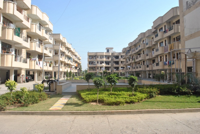
Choose a view by classifier
If you go back to the above procedure for choosing a land plot for a 9-storey residential building, then the owner of the plot should select the type of permitted use "Multi-storey residential buildings (high-rise buildings)", code 2.6.
Considering the VRI from group 2 (residential premises), you can make sure that their name and description are made in order to prevent the abuse of developers and better compliance with the requirements for the development of specific territorial zones. So, for example, if a height restriction is set in this area for residential buildings, then instead of the standard ARI “for placing an apartment building” widely used in many existing PPZs, a “low-rise housing development” (up to 3 above-ground floors) can be established by the classifier , “Middle-floor residential development” (up to 8 above-ground floors) or “multi-storey residential development” (from 9 above-ground floors). Such VRI will not allow developers to interpret their content too freely, which is quite common at the present time.
Why change VRI
There are often situations when there is a need to use the site not according to the established VRI. For example, the owner of the site with the established type of "land for gardening" had the intention to build a capital private house on it for his own residence. Or, on the contrary, the owner of the land plot for private housing intended to use it for business, wants to build a store or a car workshop on it.
How to make a change in the permitted use of the land?
This can be achieved in only one way - by changing its VRI. But there are two ways to do this: with replacement land land categories according to the RF Labor Code to another (if this is required by the new VRI) or without such a replacement.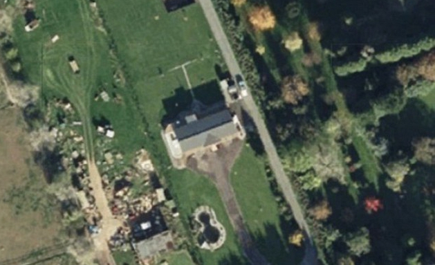
Change in VRI with changing the category of the site to another
This method of changing the VRI is suitable for large tracts of land intended, for example, for a suburban cottage village or for a new residential microdistrict when you need to transfer land from the category of agricultural land to the land of a settlement.
Changing the type of permitted use by this method allows you to set any used VRI for the site.
The procedure for replacing a category is clearly stated in the RF Labor Code, as well as in Federal Law No. 172 of December 21. 04 g
First, the following package of documents is prepared:
- a petition indicating the reason for replacing the category, existing and required category, cadastral number of the plot;
- personal documents of the applicant;
- extract from the state cadastre;
- extract from the Unified State Register;
- notarized consent of the owner, if the application is from the land user.
Documents are submitted to the authorized body of state power (Government of the Russian Federation, the Government of a constituent entity of the Russian Federation, local authorities) depending on the ownership of the land, which considers it within 30 days.
If the decision is positive, the state authority issues an act on the transfer of the site to another category. Then, the state authority sends a copy of its decision to the Rosreestr within 10 days to amend the state cadastre and the Unified State Register of Enterprises within 7 days.
Change in VRI within one category in the RF RF
This method is based on Art. 37, 38 of the Civil Code of the Russian Federation and Art. 4.1 Federal Law "On the entry into force of the Civil Code of the Russian Federation."
First, the owner of the site contacts the local Office for Architecture and Urban Planning for the PPZ of this locality. In the urban planning regulation included in the PPZ, all the main conditionally permitted and auxiliary ARIs for each territorial zone should be spelled out.
Having selected the desired type of use from the list of types of your zone, you should contact the local authorities with a statement on the establishment of a new VRI for the site. Here you need to remember that it is easiest to install it from among the main ones, for which additional permissions are not required.
Having received the appropriate decision of the authorities, you can contact the Rosreestr with a statement on the registration of changes in the VRI site.