Earth has always been and will be one of the most valuable possessions of man. In order to carry out transactions with it, establish property rights, and provide ownership, the boundary of the site must be determined first. Any legal relations and questions arising regarding the circulation of territories are regulated by the Land Code of the Russian Federation. The definition of the boundaries of the land and their documentary examination confirms the ownership of the owner. In some cases, disputes may arise over the definition of the boundary. The reason for this is errors in the design of the site, as well as violation of the borders by neighbors. Such disputes may be resolved in court or in pre-trial proceedings.
Documenting
Establishing the boundaries of the land plot, documenting with the acquisition of the right of ownership involves the provision of a certain list of documents to the authorized bodies for registration and obtaining a certificate of ownership. To do this, you will need:
- Identification.
- Documents for residential and non-residential buildings located on a plot of land.
- Two statements: the first - to UGRTSKK, the second - to UFGRP.
- A copy taken from the general cadastral plan of the locality in which the plot is located.
- Acts of coordination of borders.
- Package of technical documents.
- An extract made from a cadastral passport and a copy of the property plan.
Boundary Procedure
The boundaries of the land plot are specified in the Office of the Federal Center for the Unified Registration of Cadastre and Cartography. When submitting an application at this institution, the applicant is placed in a queue for work of a technical nature within the specified territory.
You will need to take a copy of the cadastral plan of the land plots in this area from the local administration, which must be provided to the engineer who has left for the place. Based on such a technical plan, specialists markup and draw up a map, a plan, and also perform topographic surveys of the surrounding area, which indicates the peculiarities of the location of the territory with respect to neighboring areas.
It is important not to forget to draw up acts of coordination of borders with all owners of neighboring plots. Such documents are compiled manually in arbitrary form and must necessarily contain the personal data of the parties, the location of the sites, notes on the agreement with the established boundaries, signatures, home addresses of the owners.
All documents received at this point must be certified in the district municipality, as well as present all the technical certificates that are relevant to the land. Based on this package of documents, the Office of the Federal Registration Center will put the property on cadastral registration, and will also award it a registration number and issue a special passport. If the full volume of securities has already been drawn up, you must re-apply to the same organization where, after one month from the date of application, a certificate of ownership of this land plot will be issued.
How to survey
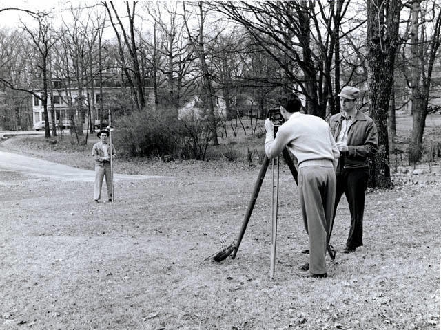
As a rule, having a document in possession of a property right or an act of a local government giving this right to a citizen, it is necessary to conduct a land surveying process. The next step is to contact a specialized company.There, with the help of a certified cadastral engineer, they will produce a land survey plan that will determine where the exact boundary of the land passes. This specialist is involved in the process of drawing up acts of coordination with related owners. The definition of the boundaries of the land should be confirmed by all persons relevant to this issue. Information about all neighbors can be obtained from the authorities of Rosreestr. After the execution of these acts or the emergence of controversial issues that must be settled in a judicial proceeding, they are applied to the boundary plan.

You can submit to the State Cadastral Chamber both an electronic version, enclosing a printed version of the land survey plan, and its paper copy. In the absence of identified errors, after some time, the land owner will be given a cadastral plan of the site confirming the entry of data into the State Real Estate Cadastre.
Boundary business
Since such a property is a property, each plot should have identification data. This is possible only if the boundaries of the land on the surface of the territory to which it belongs are determined. This procedure makes it possible to determine the coordinates of the borders and fix them in special documents, making out in the form of a boundary case.
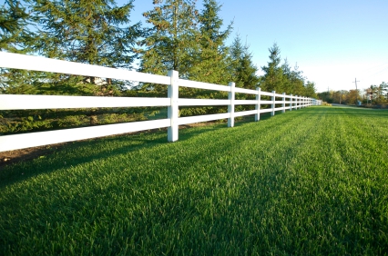
The location of the boundaries of the land is determined not only so that the owner can put up a fence in a particular place, but also for registering the territory as a property in the authorities of Rosreestr. Without such registration, it is impossible to conduct any operations with property, including buying, selling and leasing. Border surveying also helps in resolving controversial issues and in coordinating certain boundaries between neighboring areas. In this case, the act allows you to resolve all contentious issues without appeal of the claimant to the judicial authorities.
Border refinement
In the event of various land disputes, as well as actual discrepancies in the data, the information previously provided to the Register requires correction, for which the boundaries of the land plot are clarified.
In accordance with the current Law on the Cadastre, such clarifications are allowed in the following cases:
- Lack of reliable information on the exact coordinates of the boundaries of the defined area.
- If the available data do not correspond to the actual or not accurate.
- If the coordinates taken into account do not give a complete picture and do not allow to accurately determine the location of territorial boundaries on the ground.
Final documents
Cadastral boundaries of land plots are entered in the final document - the boundary plan. These data are recorded as changes in the State Real Estate Cadastre. Thus, the final documents giving the right of ownership and containing information on where the clear boundary of the land plot is located is a boundary plan and a cadastral passport.
Error handling
In order to avoid errors in determining property boundaries, all geodetic measurements should be carried out in accordance with applicable law, as well as on working instruments. Such equipment should undergo metrological control at least once a year. The best option would be if the cadastral engineer and surveyor work together for one company that has the appropriate licenses for conducting geodetic activities.
It is important to ensure that the coordinates of the property are linked to the established data of the state geodetic network in accordance with the rules of the official base navigation stations. The border of the land, its measurement and setting of coordinates must be accurate and correspond to the actual data when they are entered in the State Cadastre.Shifts of cadastral outlines with respect to their actual location should not be detected.
Dispute
If errors are detected in the process of land surveying in the pretrial order, you will need to prepare a plan to clarify the boundary. You also need to have all the acts to coordinate the boundaries of the land with adjacent territories.
When transferring a case to court, you will need not only the conclusion of the cadastral engineer, but also the data of the relevant examination, which will form the basis of the decision-making process on the claim.
The process of surveying is not so much time-consuming as it takes a lot of time and requires a painstaking attitude to paperwork. The border of the land and its documentary evidence is exactly the case when it is better to carry out all the necessary measurements thoroughly and meticulously than to come back to this issue again and again. Only patience and attentiveness will help to resolve this issue once and for all.