To determine the composition of the soil, its bearing capacity, the most effective study of the earth's layer in the natural environment, static sounding is used. The lowering depth of the probe corresponds to 10 m, but a smaller one is allowed if the bed of indigenous soil rocks passes close to the surface. With a shallow occurrence of dense soils, their incoherent consistency or clay rocks, it is allowed to lower the research probe only to a depth of 5 m. In order to determine that a layer of sufficient thickness is located under the probe cone, one well is drilled. According to her studies, the desired sounding depth is determined.
Soil Sensing Research Objectives
GOST 20069-1974 contains standards and rules for static sensing.
The procedure is performed to identify:
- characteristics of the geological element in conditions of natural occurrence (layer thickness, boundaries of a particular soil section, composition and state at the time of the study);
- the boundaries of homogeneous formations in depth and area of distribution;
- the depths of the upper boundary of thick rocky soils, large clastic soil strata;
- static tests approximately evaluate the physical and mechanical properties of the earth;
- the limit of resistance is determined, the lateral resistance of the soil under the probe;
- for artificially filled soils, a study of the degree of compaction is conducted.
The essence of the procedure
Static sounding of soils is carried out to determine the mechanical and physical properties of the soil layer, therefore, the normative characteristics of the soil are obtained as a result. When processing research data, first determine the arithmetic average of the results of one lowering of the probe to determine the characteristics of the layer. For the final result, the average values for all produced sounding points at the selected site are compared.
The research process is carried out in cycles that contain the following operating procedures:
- a gradual uniform indentation of the rod is performed with periodic fixation of the physical and mechanical properties of the soil after about 20 cm;
- recording on diagrammatic automatic tapes of all testimony of soil investigation;
- to build up the subsequent rod section the jack rod rises;
- static sounding ends when the instrument reaches the desired selected depth or maximum loads on the probe cone.
General sensing issues
When the probe is lowered, the readings of the resistance of the soil layers are taken under the tip of the device and on its side walls. The static research method is used as an independent test or combined with other engineering and geological definitions of soil characteristics. In the process of research, the values of the thickness of each layer are obtained, the formed lenses of the soil are revealed, the boundaries of the location of various types of soils, and their current state is evaluated.
All these averaged indicators are used to determine the possibility of driving piles, calculate the depth of their lowering into the ground, output data to establish the maximum depth of the pile foundation, and find optimal places for the location of research sites.
After conducting field studies by a static study of the soil, the following data are obtained:
- on the resistivity of the soil under the tip of the cone, expressed in MPa (kgf / cm2);
- about the resistance of the subgrade on the side of the cone clutch, unit of measurement - Prince.
The results of static sounding are reliable if the work is carried out according to a pre-approved plan and a task for performing geological and engineering tests executed in accordance with all the rules.
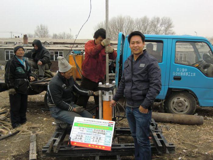
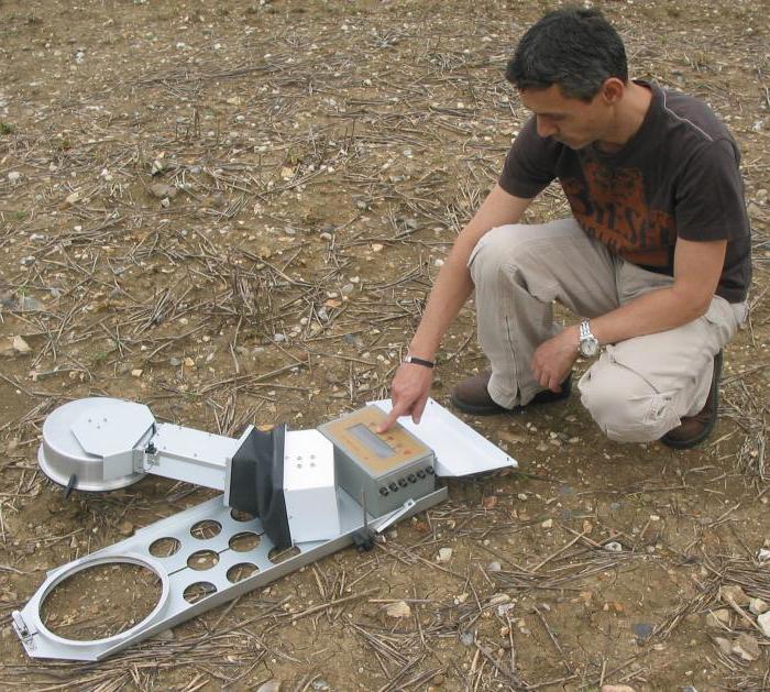
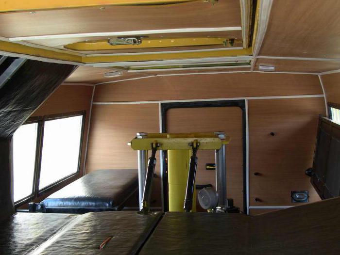
Ground Sensing Equipment
The installation used for the test consists of the following parts:
- a tip and a rod, together forming a probing device;
- a device, such as a jack, for pressing a tip into the ground, and a device extracting the probe;
- to support the installation - a statically balanced bed fixed by anchors;
- measuring and reading devices with the possibility of fixing on a flexible medium.
Tip probes are used in three common types. The first type of tip consists of a casing and the cone itself. The second type of probe is equipped with a cone-shaped friction coupling tip. The third tip includes a friction clutch, cone and expander. The method of static sensing requires that, despite the applied design of the probe, its base in area should correspond to 10 cm2. The angle at the conical peak is 60º.
According to the technology, it is required that the diameter of the coupling on the outside be equal to this indicator of the base of the case, and its length should be 31 cm. The diameter of the rod on the outside is 36 cm for a type 1 probe, and the two second types allow a diameter of up to 55 cm. This size is accepted based on technological calculations.
Preparatory work
According to the operating instructions that are issued by the manufacturer upon purchase of the machine, periodic testing of the equipment and its verification are carried out. Efficiency is determined after the purchase of the installation and before its use at the landfill. The test is carried out at least once every three months, and also after repair and replacement of any of the spare parts. The obtained verification results are drawn up by the relevant act.
The installation of static sensing is constantly subjected to wear and tear, there is a partial loss of straightness of the rod, therefore, after every 15-20 points of immersion, links are collected in a section of at least 3 m and a straight line is checked. Deviations are allowed no more than 5 mm over the entire length. The check also applies to the height of the probe tip, which prevents the length from being reduced by more than 5 mm.
When marking dive points, geodetic levels and theodolites are used, at the marked places they set up beacons in height and vertical. After conducting static sounding, the correct location of the points is re-checked. If, due to the geological features of the terrain, lighthouses are not installed, then soil planning is done to improve conditions. The sounding mast does not deviate more than 5º, otherwise the results are considered controversial.
Sounding
Static sounding is carried out in accordance with the procedure provided for in the operating instructions for field installations. Obtained results are necessarily fixed at periodic intervals on a flexible tape at an indentation speed of 1 m per minute. The immersion is considered complete if the probe is under pressure of a predetermined value.
In addition to the flexible carrier, the results of the tests are recorded in special journals. After work, the well is plugged with earth and marked with a sign on which are the test point data and the name of the organization that conducted the procedure. It is mandatory to restore soil damaged during work.
Processing received data
All the obtained characteristics of the soil are drawn up in the form of visual graphs, where the readings vary along the depth of the sensing marks. For construction, use chart feeds or data records in the sensing log.All graphs are performed on one scale, its change is allowed while maintaining the ratio between vertical and horizontal coordinates. If the mine workings are located nearby, then they are shown on the graph in separate lines.
Classification and types of soils
Underground soils are diverse in chemical composition, crystalline structure and the nature of the location in the layer. Soil subdivision is carried out in accordance with SNiP II-15-1974, part 2.
Rocky soils are hard soil deposits lying in a dense massif, sometimes fractured areas are allowed. These include igneous rocks (granites), sedimentary deposits (conglomerates, sandy soil), metamorphic layers (schists, gneisses, quartzites). Soil formations of this type are characterized by great compressive strength, good resistance to freezing, and are an excellent base for construction.
If rocky soils are characterized by the presence of cracks, then their performance deteriorates in terms of freezing and strength. Such soil is divided into groups determined by the salt content, softening ability and solubility in water.
Non-rocky soils are formed by the sedimentary method in natural conditions and do not contain rigid structural bonds in their lattice. Depending on the size of the particles, they are divided into coarse-grained, sandy soil, clay-dusty and biogenic accumulations.
Characterization of coarse soil
These include unconnected pieces of rock formations, in which fragments up to 2 mm in size prevail, and they are contained in a mass of not more than 50%. The form and size of granules distinguish these types of soils: boulder, block, gravel, pebble, gravel and wood. They are considered an excellent base for heavy building and mechanical structures, if they are located on the previous dense layer. Compression under the influence of load is negligible. It is good if the total soil mass contains up to 40% of sand or clay and dust filling, which gives additional strength characteristics.
Sand Soil Indicators
In their composition, these types of soils contain mineral particles and quartzite grains with a grain size of not more than 2 mm. Clay components - not more than 3%, which leads to the loss of plasticity. Depending on the grain size, sandy soils are divided into types:
- dust is made up of particles with a diameter of 0.05 to 0.005 mm;
- fine fraction with a diameter of more than 0.1 mm;
- average fineness with a diameter of more than 0.25 mm;
- large particle diameter is 0.5 mm or more;
- the gravelly species contains inclusions with a diameter greater than 2 mm.
The bearing capacity of the sandy base increases with increasing grain size. Non-flexible sandy soils have a low degree of compression; after the start of the load, the sediment quickly ceases. Coarse-grained types of sandy soils during loading increase the density and, accordingly, strength.
Types of soils, such as sand with clay, in some cases show the ability to subside and swell. The first occurs under the influence of its own weight and soaking, the second increases the volume of soil, and when dried, it decreases, which leads to cracks and loss of strength.
Clay rocks
Clay-type soils contain small scaly particles with a diameter of not more than 0.005 mm. A small number of dusty sand grains can be interspersed. Clay soil refers to heaving rocks, since thin capillaries and large planes between particles for moisture content lead to rapid saturation with water, which destroys the integrity of the formation under the influence of frosts. Clay soils are divided into the following:
- clays - contain clay flakes more than 30%;
- loams - the number of flakes decreases to 10-30%;
- sandy loams are characterized by a content of 3 to 10% of the scales.
Clay soils change their strength depending on humidity. Dry can withstand a significant load. From the content of clay particles depends on the indicator of plasticity and fluidity.
Quicksand
The bases, which, when opened, begin to move, exhibiting greater fluidity and viscosity, are called quicksand. They include sand dust, clay scaly particles, silty additives. Quicksandies contain a lot of moisture, which brings the mass into an almost liquid state. Soils of this composition are divided into true quicksand and unconventional. The first ones contain a lot of clay and colloidal inclusions characterized by fast saturation and poor moisture loss. Their swimming occurs when the moisture content in the amount of 6-9%, the transition to a fluid state is observed after adding moisture in the amount of 15-17%.
Unconventional quicksand includes sand formations that do not contain clay. These soils are characterized by high moisture perception and the ability to quickly give it away. They pass into the current state, and such properties of soils make their use in construction impossible.
Mechanical and physical characteristics
An important indicator is the particle size distribution, which allows you to find out how many percentage particles are contained in the mass. The standardized particles suitable for detection include grains: 40 mm - pebbles, from 0.25 to 2 mm - sand, 0.05-0.25 mm - dust, 0.005-0.05 mm - dust particles, up to 0.005 mm - clay scales.
Volumetric weight shows how much one cubic meter of soil weighs; for different rocks it ranges from 1.5 to 2.0 tons per 1 m3. The porosity coefficient reveals the ratio of the total number of pores to the entire soil volume. The moisture indicator determines the ratio of the mass of moisture contained to the weight of the same volume in the dry state.
The connectivity index reveals the ability of small grains and particles to remain in integral form under load. Clay soils have the highest rate; in sand formations, mutual cohesion of particles is completely absent.
Plasticity is the property of a rock to change shape under the influence of a load and remain unchanged after its removal. The highest indicator is for clayey rocks; the lowest values are shown by sands and gravelly bases.
Static sounding reveals an indicator of the strength of the investigated layer. Strength is the ability to remain intact when exposed to a load.
An important characteristic of the breed is shear resistance. The movement of one layer relative to another occurs along certain slip planes. Under the action of the load, the particles resist shear, the amount of adhesion and forms the desired index.
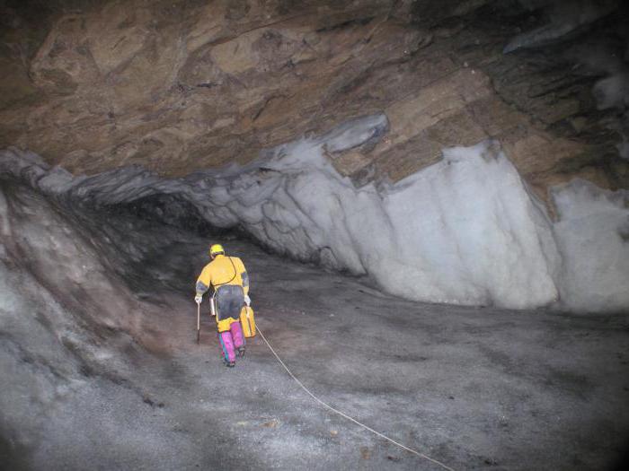
Eternal Frost
Groundwater forms not only fluid accumulations inside the reservoirs, but also solid ice formation. Permafrost is called cryolite region, consisting of ice layers. They are formed in the mountains, on the surface of plains with a high degree of mineralization and underground. Permafrost is formed in areas with constant tectonic displacement of horizons by wet rocks or as a result of freezing of previously accumulated liquid in underground layers.
In almost all areas of permafrost, migratory ice accumulations occur. The rock frozen as a result of many years is the result of prolonged accumulation of cold in the mass of underground strata. Many researchers talk about its centuries-old existence since ancient times. As a result of the established harsh climate in places where permafrost is located, the destruction of ice layers is not expected if the natural balance is not disturbed as a result of human activity. When used as a foundation for the construction of strata with frozen soils, attention is paid to the careful attitude to the integrity of the surface, otherwise an established equilibrium may occur.
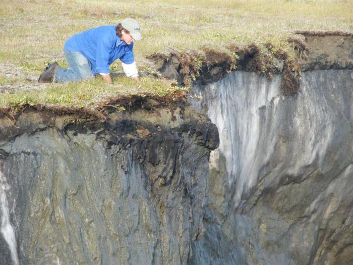
Lenses in the ground and freezing depth
Permafrost develops unequally within a vast territory. Sometimes isolated spots occur, and sometimes whole areas without a break are frozen. Studies of the layer of thawed soil do not always determine the presence of lenses in it - frozen sections of the ice accumulation.If the building is being built in the area of melt soil and a lens has been missed, and it is partially located above it, then the heat from the structure during operation melts the ice accumulation and unpredictable subsidence or landslides are created.
Sometimes ice lenses are artificially formed as a result of disruption of natural heat exchange between the soil surface and depths.
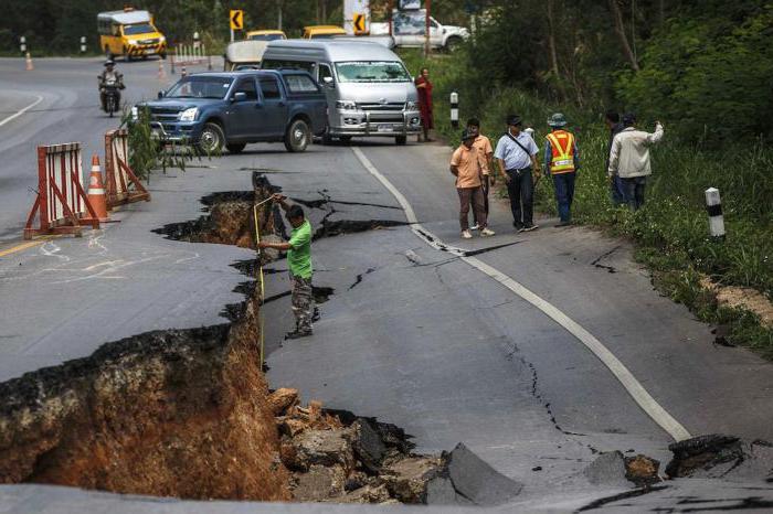
The ice stored in the depths swells with increasing temperature, deforming the soil. The strength of the base is affected not only by individual ice lenses, but also by the natural depth of freezing of the soil. The indicator is calculated for the coldest period in the area. At the same time, the maximum humidity of the rock and the conditions for the absence of snow on the surface are laid in the calculation.
The freezing depth is taken into account when laying the foundation for the construction of buildings and structures, while the bottom of the foundation is buried below the accepted freezing mark. In the calculation, an indicator is obtained that slightly exceeds the real freezing depth. It is taken as a basis, since the calculation is carried out for those cases when a combination of circumstances leads to the worst operating conditions.
In conclusion, it should be noted that the study of soil formations by the method of static sounding helps to expand the human habitat due to the permafrost zone and extreme Siberia, to build modern villages and processing plants there.